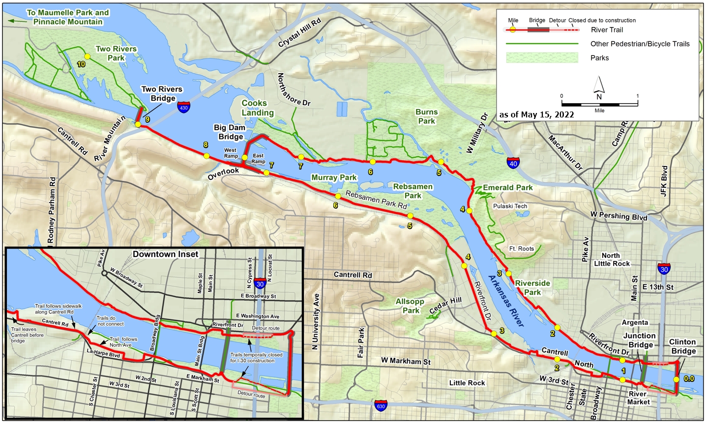
Utilize our maps of the Arkansas River Trail System and surrounding areas for planning your cycling excursion, hike, wildlife-watching trip, or other outings.
Work Continues
Work continues on efforts to close the loop. The next project will stabilize the bank of the Arkansas River so that a ramp can connect the Medical Mile with the new bike/ped bridge near the Arkansas Heritage building. For the portion of the trail near Dillard’s and the Episcopal School, the current detour recommends staying on the south side (Episcopal School) when going east toward downtown and staying on the north side (Dillard’s) when going west. Use caution at driveways and crosswalks. See Detour Map.
The Southeast Trail offers an alternative bike route, with low traffic and good sightlines. Starting at the back gate of the Clinton Library, the route goes 13 miles, past the Clinton Airport and Little Rock Port, to the David D. Terry Dam and Dam Site 6 West Park.
Southeast Trail Bike Route Map – jpg | PDF
Other Maps
- Arkansas River Trail Map (PDF) (updated October 2018)
- Grand Loop (PDF)
- Burns Park Map (PDF)
Arkansas River Trail Brochure and Map (2017)